Distance: 24km (600m), total of 85km
Time on the trail: 10 hrs
Planned route: map
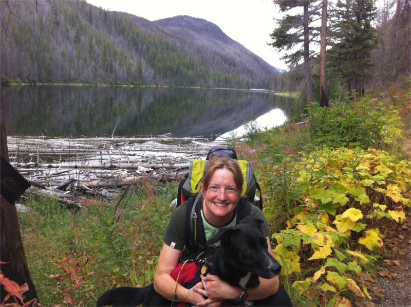
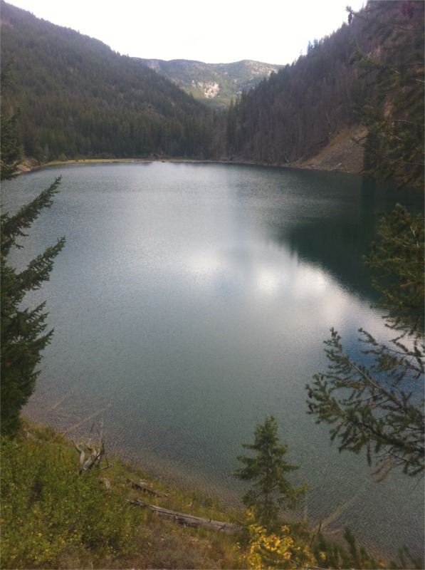
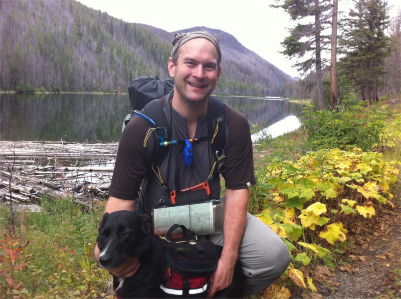
Today we left our lovely B&B loaded up with ‘the full Scottish’ (breakfast) around 10:30 so we had a fairly late start. We followed our planned route along minor roads before climbing to join the Puggle Line, a dismantled railway. The track was a mix of lush grass, hard packed rock and swamp bog. The views traversing around all the valleys would have been nice if the sunshine persisted for more than 10 minutes at a time :(. Around 1pm we stopped for lunch and brewed up some soup. While we were sitting we saw two other hikers joining our trail from across the river. We soon caught up with them meeting Marion and Graham, two Scots on their fifth challenge. Like most other people we’ve met, they have great tales of good weather 🙂
We walked with them on and off through the small hamlet of Fersit and on through the woods. Our plan was to camp in the woods but we pushed on through to make our next two days into Kingussie more reasonable. We eventually made camp by the side of the river after ‘negotiating’ the deer fence :). What a lovely spot it was too – right by the river, under the shelter of trees and hidden from any other hikers :). Read more…
Distance: 22km (220m), total of 65km
On the trail: 8hrs
Planned route: map
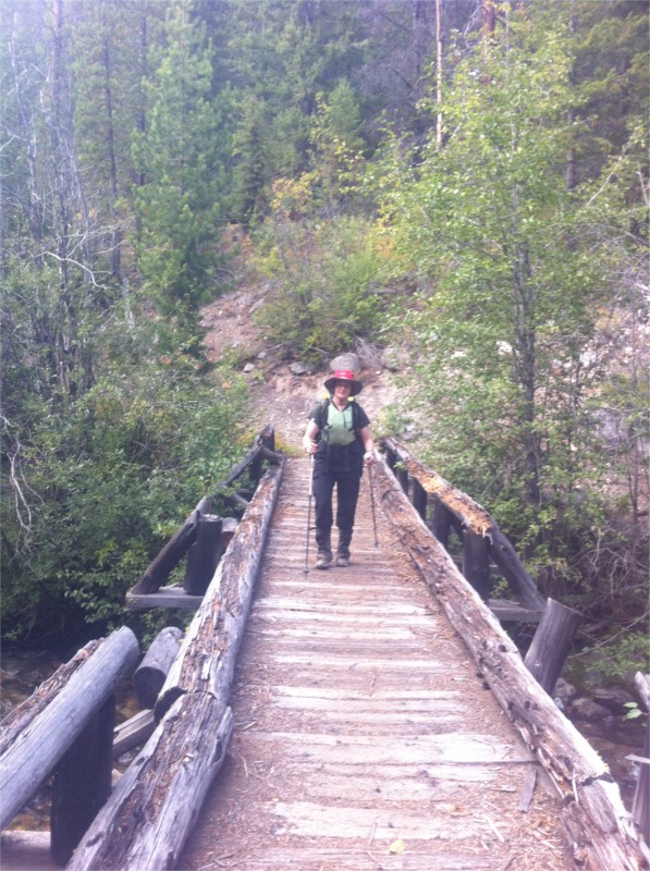
We stopped about 3km short of Glenmallie last night. The walk into our camp was a horror compared to the nice trek out to Invermallie. It was raining hard when we woke so we decided to break camp and eat something cold in order to get on our way quickly. After leaving camp around 9am we picked up a nice LRT (landrover trail) and had a very fast walk to Glenmallie then out to Invermallie where we had a hot lunch sitting under a huge oak tree. The walking today was easy in comparison, mostly flat on nice trails or roads. The only surprising thing was the discovery of the ‘Gairlochy fairies’ in the woods (see pics below). We found them by following the Great Glen Way Trail from the end of Loch Arkaig to Gairlochy. Read more…
Distance: 20km (1000m climbed) – total: 45km
Time on the trail: 12 1/2 hrs
Planned route: map
Today started by trying to dry out socks and other wet soggy stuff from our late night yomp. The weather cleared and we hit the trail with Alan and John intending to hit our planned Monroe. After climbing the ridge with Alan (John has headed in another direction) the winds were whipping up and the climb to the summit looked like a real scramble. Truth be told we were all feeling a bit knackered so we opted for our bailout route which took us down Glen Mallie. Our route better describes the route as ‘a wonderful lush green valley with easy tracks’. Well I think he must have confused it with somewhere else. Ever heard of Lake Baikal in Russia? It supposedly has 1/3 of the worlds fresh water supply. Read more…
Distance: 25km (1100m climbed)
Time on the trail: 11 hrs
Planned route: map
We arrived into Mallaig around 5:30pm on what would appear to be the TGO express train. It was packed with challengers who jumped off at the different start points. We met several folks from our 2009 challenge and made many new ones. Overall challengers are quite a social bunch.
We had a great dinner in the local pub with fresh locally caught seafood and a pint or two if the local real ale.
Our challenge started at 9am by signing the start book. We then headed down to the Inverie ferry which left packed to the gills with the 47 challengers starting at Inverie. After landing a great deal of self control was exercised preventing a quick pint in the old forge inn. Read more…
Let’s talk gear. Now my husband is the research king of the best, the most minimal, the lightest, and the most functional gear on the market. But while I love the idea of a 20lb pack total, I also need something that is comfortable. If I’m cold, wet, have blisters, haven’t slept well, or am experiencing back spasms due to an uncomfortable pack, it’s not going to be a pleasant trip for anyone.
Read more…
Lynn and I leave on our second TGO challenge in a few days. We are going to be starting from Mallaig on the western coast of Scotland (just off the Isle of Skye) on Friday, May 13th. We’ll then take 13 days to walk the estimated 205 miles to end at the ocean below Dunnotar Castle. Our hike starts with a ferry boat ride to Inverie where we’ll enjoy a pint (or two) in the remotest pub in Britain, the Old Forge.
We’ll have our SPOT satellite tracker with us so you’ll be able to follow both our planned and actual routes at http://www.dooger.org/topo/tgo.htm. We may post a few blog entries along the way which you will find right here along with any Tweets from the trail. You can also follow us on Twitter under @chillidemon. I’ve also been experimenting with a new social hiking site in the UK which aggregates Twitter and GEO tracking feeds into a single map. You might like that too:
The Stickpic – simple, tiny and small. Looks like an interesting tool for the solo hiker self-portrait.
$12 from http://thestickpic.com/

The prior night was pretty cold due to a light breeze which blew through the tent. This was great though as it meant we had zero condensation in the tent making our morning pack up easy and the tent pounds lighter (dry tent == good tent :)). We hit the trail around 9am in high spirits – the hike out was meant to be beautiful and with blue skies we would have a wonderful last day on the trails.
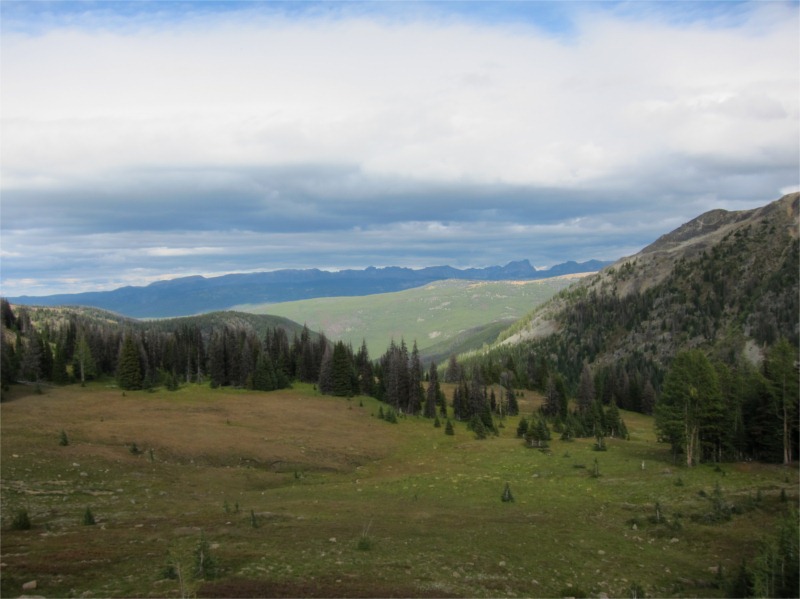
The trial did not disappoint – though we have 2100’ of climbing back to the car the views were simply amazing. This was by far the best day on the trails and we were all (including Jilly) in high spirits.
After climbing for about an hour we took a short spur trail to an overlook at the cutely named Hoot Owl Camp which has a epic view across the valley to Rampart Ridge. From there we continued to Lucky Pass and then finally headed through Eightmile Pass before descending back to the car at the trailhead. This completed our estimated 50 mile loop.
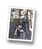
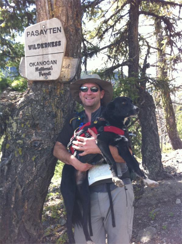
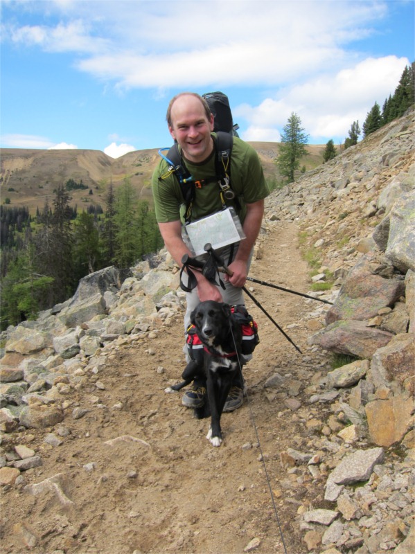
Overall the trip was ok with some really high points (hiking from East Pastayten out) and some super lows (Bunker Hill day). Compared to my prior trip to the Eastern Pasayten this was a disappointing trip as there were very few views along the route. I’m sure my perception would change if we’d had good weather on Bunker Hill. Despite all this, I really did enjoy the trip. This was our first serious backpacking trip with Jilly and she did super well. She settled into a routine on day 2 and learned to hike behind me in a nice heel for hour after hour (Lynn gets the credit for the training :)). It’s super encouraging as she’s barely 2 years old and will be better behaved as she matures.
All in all, it was great to get out and away from the city.


After our dismal “lost day” yesterday we awoke hoping for a better trail. The weather looked much better today with clear blue skies already showing by 7:30am. Once the mist burned off the valley floor, it was a lovely day with the sun shining through the burnt trees. The hiking here was actually quite good. The burn trees were nice and open with lots of colorful fireweed shining brightly along the trail. No real wildlife to speak of but lovely open woodland views.
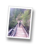
We soon hiked the 4 miles to Big Hidden Lake, the first of the three hidden lakes. We encoutered several groups of people our our hike today – what looked like a hunter/guide snoring in the sunshine outside the guard shack followed by a group of men fly fishing in float tubes on middle hidden lake. Compared to the first three days, this was a huge number of people in such a short time.
After leaving Big Hidden Lake, we saw our first bear sighting – Jilly was quite excited and would have run off after him had she been off leash. This bear was pretty large too – at least 100lbs or more. We then spent the next 30 minutes making lots of noise just in case he had friends along the trail.
Soon after First Hidden Lake we ran into a huge pack train of horses – three people and some 10 horses all heading in the direction of Hidden Lakes. We assumed this was another High Hunt camp going in for the week.
From the Hidden Lakes we followed the trail passing Cougar Lake (no Cougars!) to reach our planned camping spot at Diamond Creek at 4pm. This was a lovely little spot with a great deal of flat camping and ample water supply. Here we met Dori, a lovely USFS Ranger who was just heading out for a 9 day wilderness patrol. She was hoping to reach Hidden Lakes for the night be decided to join us in camping at Diamond Creek given the fading light. We chatted with Dori for several hours learning about the USFS Rangers, patrol cabins and how the USFS regulates the Pasayten.
The camp here was great and it was wonderful to have several hours to putter around getting things setup. This was the first night where we’d arrived in camp and not been rushing for daylight to get things sorted. The weather update from Dori was good for tomorrow – sunshine and clear skies for our final 9 mile hike out to Billy Goat Corral.


The predicted weather came through with continuous showers falling all night. By the time time we hit the trail at 8:45am, the rain was still falling but had receded to constant drizzle. Full rain gear came out with leggings, and our favored Paramor jackets.
From our camp at Peeve Pass was continued on climbing 1400’ up to Bunker Hill (7100’). The weather today was really unfortunate as the views along Quartz Mountain would have been great. After descending the mountain we bumped into our first hikers of the day, a young man and his dog all kitted out. They were moving along at a fairly fast clip and soon passed us. I found the hiking up Bunker Hill to be hard going – it was super steep with little switchbacks. It was also very hot and humid. On reaching the glorious summit, the views would have been amazing(!) if not for the torrid weather :-(.
We crested the summit and continued down following a well worn stock trail. The trail soon started descending down switchbacks through an old burn area which lots of blow down. I became worried we’d missed the trail and was getting concerned we would become lost. We backtracked up the hill to try and get a signal on my GPS (iPhone with Memory Map). After fudging around with the settings (Note: flight mode needed to be off!) we got a signal and found that we’d taken a wrong turn and were following the old trail #456 which we’d been warned against. This takes you off Bunker Hill in a SSE direction and we needed to follow the trail in a NNW direction (genius Ellis was off by 180°).
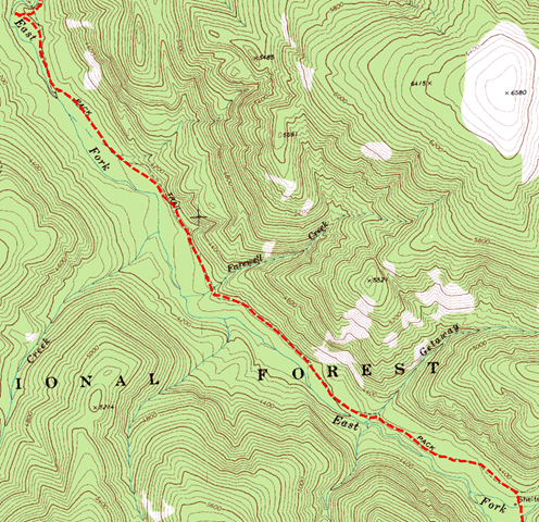
We soon backtracked and, after double and triple checking compass, GPS, map and trail guide, we found the missing trail about a mile back up the hill. The trail was actually marked via. a series of cairns (rock piles) and had a signpost obscured in the trees. I’ve marked our lost route in blue in the map fragment below. This last bit really bothered me and we ended up being super careful and even second guessing our route and we descended down the correct trail. The trail dropped into a small lush valley before once again descending into an old burn area. I was following the GPS route pretty carefully as the trail was again hard to follow. It veered way off at one point so much so that I decided it must be wrong (I’m sure you’re getting the picture now). After yomping around again lost for about an hour we finally found the trail again and then picked up speed.
At this this point we’d lost a good three hours and I was very worried we would be stuck on the high hillside with no flat camping spots for the night. Luckily we were able move fast with most of the trail being down hill. We soon left the switchbacks and sighted the Pasayten River. Our target camp at the East Fork was now only 1.5 miles away.
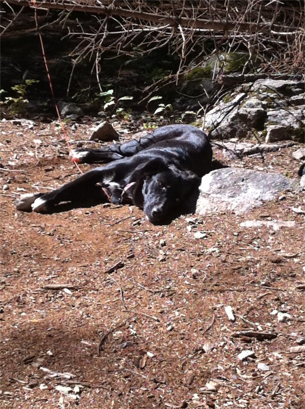
We rolled into camp at 7:15pm with only 30 minutes of daylight left to setup and cook. Little Jilly was dog tired and soon curled up into a little ball by the side of the river. We followed along and were all soon out in a deep sleep hoping for a better trails the following day.


Recent Comments