TGO route submitted
 I spent time over the holidays musing over the route for our planned crossing across Scotland as part of the RAB TGO Challenge in May. I’d previously purchased maps for Quo v2.0 which were extremely helpful in the planning process. Prior TGO trip diaries on the Phil’s Doodlecat TGO site and suggestions from Andy Howell’s post were invaluable.
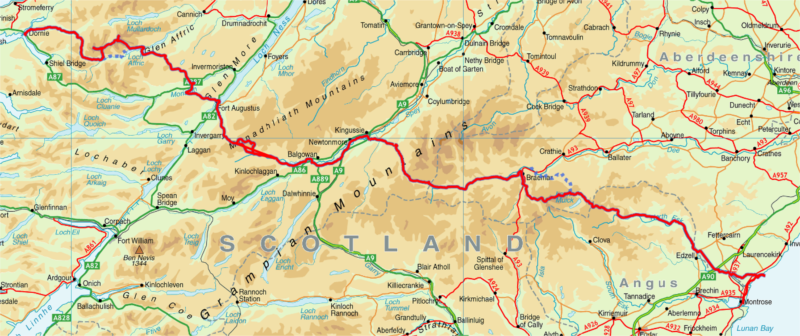
Sadly, my plan of visiting several Whisky distilleries along the way didn’t pan out… Here’s the planned route (by day):
- Dornie to Falls of Glomach [Scottish Hill Tracks #266]
18km, 1300m ascent - Falls of Glomach to Coire na Cloiche
FWA: Falls of Glomach to Athnamulloch Bothy via. Alltbeithe
20km, 1150m ascent - Coire na Cloiche [Wild Camp] to Cougie Lodge B&B
FWA: Alltbeithe Bothy to Cougie Lodge
25km, 1300m ascent - Cougie Lodge to Ft Augustus
27km, 700m ascent - Ft Augustus to Garva Bridge via. Carrieyairack Pass
FWA: Avoid optional side-tour [2] at Corrieyairack Pass
28km, 400m ascent - Garva Bridge to Kinguissie
30km, 500m ascent - Kinguissie to Glenfreshie Lodge
16km, 500m ascent - Glenfreshie Lodge to Forrest at Cairn Geldie
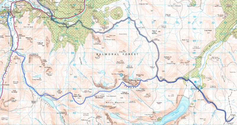
18km, 810m ascent - Forrest at Cairn Geldie to Braemar
20km, 290m ascent - Braemar to Shielin of Mark
FWA: Braemar to Shielin of Mark via.
30km, 2100m ascent - Shielin of Mark to Tarfside
18km, 580m ascent - Tarfside to North Water Bridge
25km, 220m ascent - North Water Bridge to St Cyrus (then onto Montrose)
18km, 480m ascent
Total of 293km (183 miles) and 10330m ascent.
FWA == foul weather alternate.
Day 10 is a whopper of a day and passes over some very high terrain. Fingers crossed for great weather!
I’ve booked all our airline tickets from Seattle so we’re committed now. The focus over the next three months is going “ultra-light” – my strategy? Losing my “winter fat”… 🙂
That is a sound first time Challenge route. You will come across many other Challengers following it as well. have a good walk.