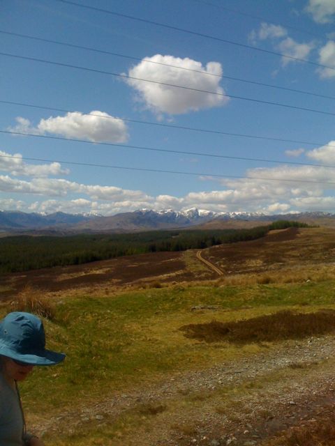
Just arrived to Ft Augustys after an epic 28km hike. Easy terrain but hard on the feet. Currently in the pub by the lochs inhaling beer and food. Our planned camp was outvoted in favor of a BnB stop 🙂
Tomorrow we head back to the mountains for a Munro or two then onto our wildcamp at Garva Bridge.
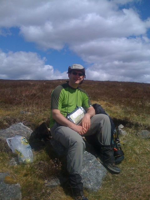
Lynn says ‘I’m not dead yet’ 🙂
The next leg of our trip started at 530am today. Up bright and early to see if the weather had improved. Yikes, there’s still snow and galeforce winds on the coast where we start. Luckily the genius folks at TGO make sure everyone has a foul weather alternate (FWA) route which we’ll no doubt take advantage off.
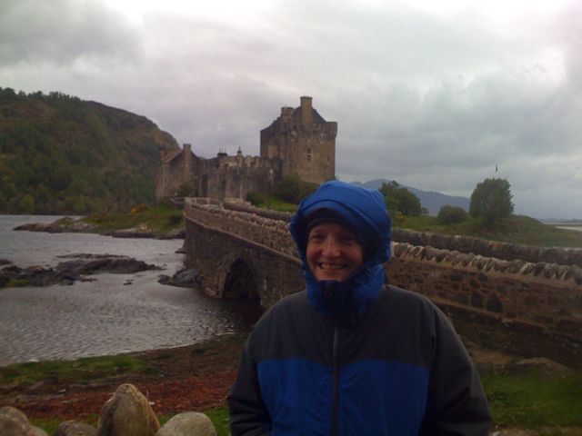
After a quick drive to Manchester airport we waited for our little turboprop service to Inverness. Then a quick stop for last minute items like extra thermals, extra large tent pegs (for the storm guy ropes I had the foresight to pack) and some fuel for our stoves. From Inverness we took the train to Kyle if Lochalsh before finally arriving in Dornie. The train was packed full of ‘challengers’ who all jumped off before we arrived in Dormie. Supposedly the train line was used to film Harry Potter on his way to Hogwart’s.
Dornie is a small village famed for Eileen Donal Castle of ‘Highlander’ fame. It’s very picturesque. Off out for some liquid food, real food then bed for an early start.
The weather here is BAD with heavy winds and rain. We’ll be taking our FWA route over the next three days to our B&B. Tomorrow we head for the Falls of Glomach and our first wildcamp.
The latest forecast for Thursday:
How windy? Southwesterly 40 to for periods 50 to locally 60mph gusts 90mph.
How cold? 900m: 0 or 1C, but will feel as cold as minus –16C directly in the wind. Strongest winds will be focussed in the afternoon.
Yikes… the weather for this weekend is looking pretty nasty. Gust up to 90 mph (and I’m not talking about my wife)…
https://www.mwis.org.uk/mountain/WH.PDF
There’s a nasty storm over Scotland right now – the above forecast is for Thursday but will ease off over the weekend. Hopefully our new gear will keep us nice and warm…
N.
I recently purchased a SPOT GPS tracking device. It’s remarkably simple with four buttons – help, power, ok and 911. Pushing ‘help’ sends a page to your list of trusted friends and is intended for things like ‘my car’s broken down’, etc. The 911 button is obvious which leaves the ok. Pushing ‘ok’ sends a page to your list of friends and also records your GPS postiion. If you push and hold down OK, the pager goes into tracking mode and will send out your location every 10 – 20 minutes. This can be be tracked on a map so folks at home know where you are 🙂
I spent a little time today hacking up a Live Maps mashup that shows our planned route (in red) and the progress we’re making (in blue) as reported by our SPOT tracker.
[Large Map]
 Just got a nice package in the mail today with final details for our upcoming TGO hike in May. We’re hikers #99 and #100 out of an amazing 379. I was lamenting the fact that my training regime hasn’t been all I would have hoped and thought better of it since there are lots of over 60’s on the hike including some 80 year old folks. Amazing!
Our starting point of Dornie and finishing point of St Cyrus seems popular with 49 starting from Dornie and 89 ending in St Cyrus. I’m sure it’s going to be quite social 🙂
I’ve been contemplating the meals for our forthcoming TGO Challenge in May and have been thinking about experimenting with de-hydrating some of our home cooking. Both Lynn and I are avid cooks – I like to make Thai/Indian and she likes the traditional stews, Italian, casseroles, etc.
I found some interesting articles on Andy Howell’s blog going over the basics of dehydrating along with some great recipes. Freezer Bag Cooking also has tons of information on everything you’d ever need to know. So it could be Thai Green Curry, Chicken Panang, Phai Thai Noodles for us!
 Just heard back from the TGO vetters (Ana and Alvar) that our route is go! They provided some really helpful advice on some of the trickier portions of the walk. Very impressive service – I hope to meet up with them in Montrose when we’re all done.
We now have most of the trip sorted including our flights from Seattle to Manchester, getting up to the TGO route start and back again, and have booked our a few “deluxe” overnight stays in a B&B’s as we go across Scotland :-). Our paper OS maps arrived today by Airmail from MapKiosk who appear to have the best online shipping and prices for OS maps.
 I spent time over the holidays musing over the route for our planned crossing across Scotland as part of the RAB TGO Challenge in May. I’d previously purchased maps for Quo v2.0 which were extremely helpful in the planning process. Prior TGO trip diaries on the Phil’s Doodlecat TGO site and suggestions from Andy Howell’s post were invaluable.
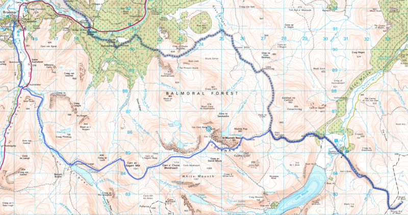
Sadly, my plan of visiting several Whisky distilleries along the way didn’t pan out… Here’s the planned route (by day):
- Dornie to Falls of Glomach [Scottish Hill Tracks #266]
18km, 1300m ascent
- Falls of Glomach to Coire na Cloiche
FWA: Falls of Glomach to Athnamulloch Bothy via. Alltbeithe
20km, 1150m ascent
- Coire na Cloiche [Wild Camp] to Cougie Lodge B&B
FWA: Alltbeithe Bothy to Cougie Lodge
25km, 1300m ascent
- Cougie Lodge to Ft Augustus
27km, 700m ascent
- Ft Augustus to Garva Bridge via. Carrieyairack Pass
FWA: Avoid optional side-tour [2] at Corrieyairack Pass
28km, 400m ascent
- Garva Bridge to Kinguissie
30km, 500m ascent
- Kinguissie to Glenfreshie Lodge
16km, 500m ascent
- Glenfreshie Lodge to Forrest at Cairn Geldie
18km, 810m ascent
- Forrest at Cairn Geldie to Braemar
20km, 290m ascent
- Braemar to Shielin of Mark
FWA: Braemar to Shielin of Mark via.
30km, 2100m ascent
- Shielin of Mark to Tarfside
18km, 580m ascent
- Tarfside to North Water Bridge
25km, 220m ascent
- North Water Bridge to St Cyrus (then onto Montrose)
18km, 480m ascent
Total of 293km (183 miles) and 10330m ascent.
FWA == foul weather alternate.
Day 10 is a whopper of a day and passes over some very high terrain. Fingers crossed for great weather!
I’ve booked all our airline tickets from Seattle so we’re committed now. The focus over the next three months is going “ultra-light” – my strategy? Losing my “winter fat”… 🙂
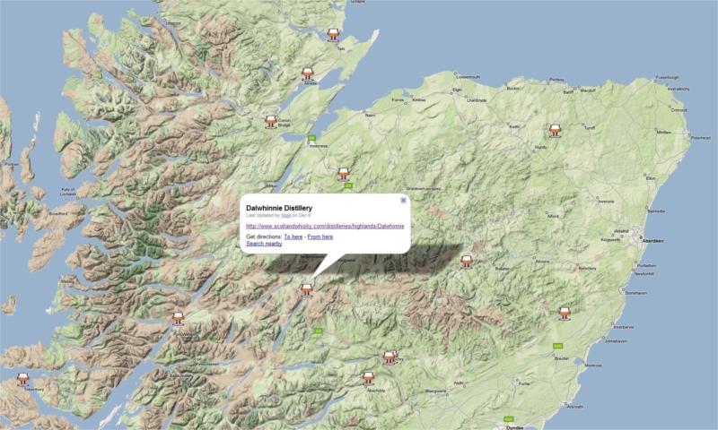
I’m in the process of planning our route across Scotland for the 2009 TGO challenge. I love Scotch and was hoping to drop in for “wee dram” in a few distilleries along the way. Alas, the only one that’s looking hopeful is Dalwhinnie.
Google Maps for your viewing pleasure here.
My copy of TGO Magazine just arrived courtesy of Zinio Reader. I won’t rant about how much I hate Zinio but it’s the only fast way to get overseas publications… Sigh…
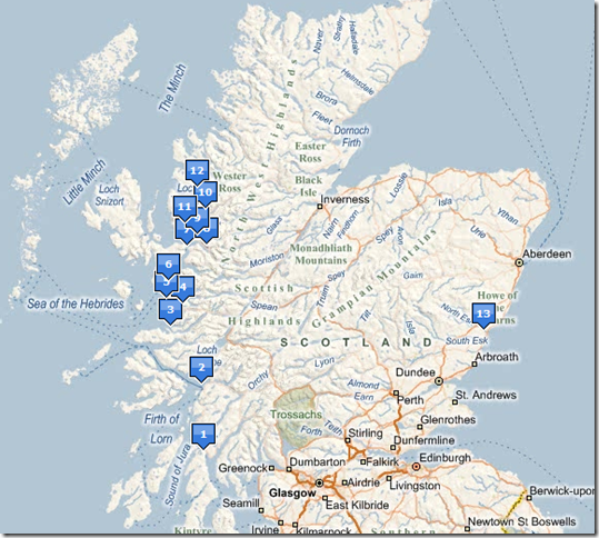
This month is TGO month and the magazine includes a complete write up on the TGO challenge along with the 2009 entry form. A bunch of us are seriously considering taking on the challenge next year – it’s a coast-to-coast walk from East to West Scotland that has to be completed in under 14 days. It’s called “The Challenge” since each challenger or team has to completely plan their own route (with feedback provided on route choice).
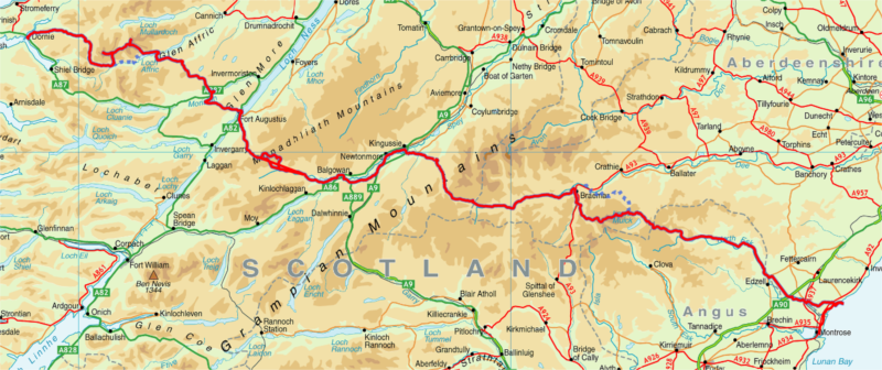
For kicks, I plotted the official East Coast starting points on Live Maps to get a sense of the scale of the walk. Click on the map below for details. We have until early October to submit our entry forms.
Fingers crossed, it should be a lot of fun 🙂
Update – Brett has posted an updated map here.
Recent Comments